

RYLSTONE shot to fame when members of its Womens’ Institute chose to become the original Calendar Girls.
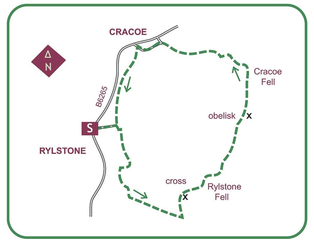
For this moorland walk, which links a series of local landmarks, start from near the pond, close to the lay-by just along the main road.
The Barden Moor access area can occasionally be closed, though on Sundays it is normally open. If in doubt, ring 01756 718000 or 710331. Dogs are not permitted.
Cross the road to a lane opposite the pond, and just beyond the church turn right on an enclosed track.
At the far corner it continues alongside a wall into a field. Above, Rylstone Cross and Cracoe obelisk make arresting skyline objectives.
The track swings right, down through gates onto a rough lane. Turn left, and as it starts to rise take a gate on the left at an information board. A track climbs past a plantation to a gate into the access area. Ascending past new trees, as it starts to level out, a green way heads left with a fence. Rising to a stile in it, a thinner path slants up to run beneath rocks.
Meeting the moortop wall the path runs to a stile at a wall-corner, with the heathery heart of the moor over the wall. Follow the wall away to quickly reach Rylstone Cross, a classic viewpoint commemorating the Paris Treaty of 1813.
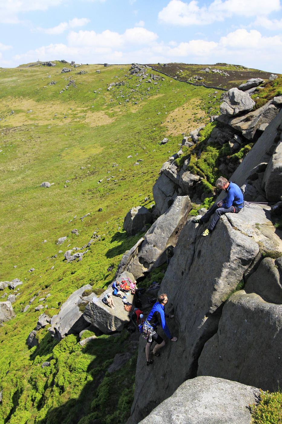
The next stage is a steady rise to Cracoe Fell obelisk. A path crosses to the wall. Ignore an early fork to the left and remain with it above high crags popular with rock climbers.
After the main group of crags a second cluster can be easily negotiated, before the path rises again beyond scattered boulders.
The wall curves left to a stile, over which is a short climb to Cracoe's War memorial with its magnificent panorama.
The next objective is Fell Lane descending to Cracoe from the foot of the moor. A level path heads away from the obelisk, parallel with the nearby wall.
After 150 yards fork left to start the descent, winding around to a pile of stones. Just beneath, the route follows a grooved slant down the fell.
Several other tracks are absorbed, and a small cairn indicates the continuation at a briefly fainter point. Just below a lower junction a second cairn sends a steeper path straight down to the reedy moor foot, with the intake gate to the left behind sheep pens.
The grassy lane descends to the village, and just before the main road turns left on a narrow lane, right at the end, then left again as it runs behind the village centre with its pub and cafes.
Keep straight on alongside a stream, but just before the main road turn left up a walled track back to Rylstone, finally entering a field to approach a farm. From a gate at the end, the lane-head is rejoined to finish where you began past the church.
This walk is found in Paul’s book ‘Walking Country – Malhamdale’ (£5.99 - www.hillsidepublications.co.uk).


Comments: Our rules
We want our comments to be a lively and valuable part of our community - a place where readers can debate and engage with the most important local issues. The ability to comment on our stories is a privilege, not a right, however, and that privilege may be withdrawn if it is abused or misused.
Please report any comments that break our rules.
Read the rules here