
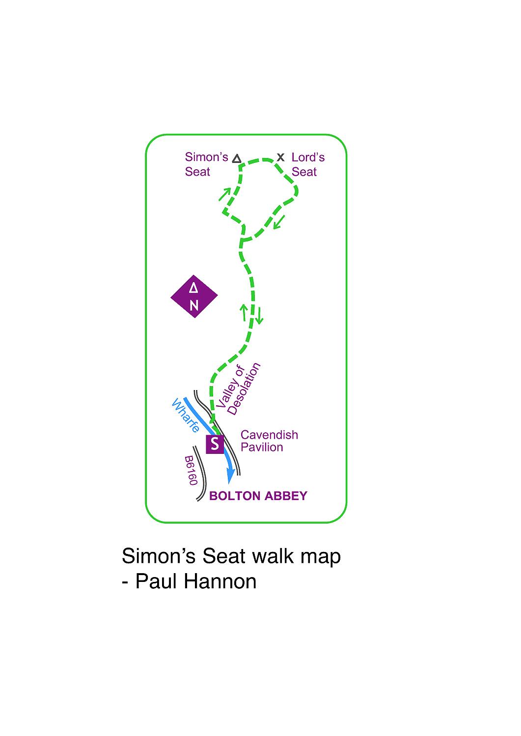
START FROM the Cavendish Pavilion car park off the B6160 just north of Bolton Abbey, turning by the memorial fountain.
Barden Fell access area can be closed on a limited number of days for grouse shooting (during August-December) or at times of fire risk (not currently!), though is usually always open on Sundays.
If in doubt, contact the estate office on 01756 718000.
Cavendish Pavilion stands on the Wharfe’s bank at the entrance to Strid Wood, with refreshments and gift shop. Cross the bridge and take a broad path upstream.
Entering trees at a gate it forks, take the upper one zigzagging onto a road, and rise left to a brow.
A gate on the right alongside Waterfall Cottage is the start of a permissive path leading to the moorland access area.
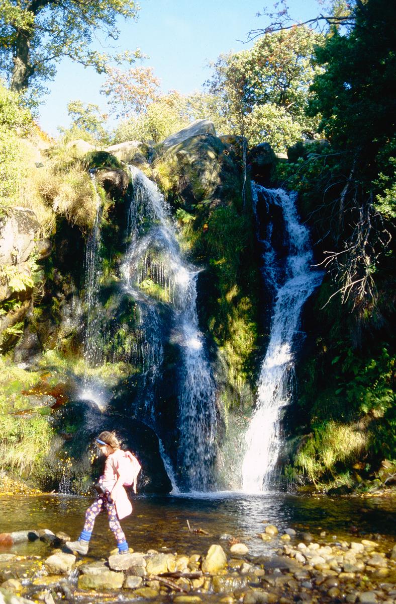
An inviting green track heads left past the cottage to a gate, where a firmer track winds along to fade by a pond, with Posforth Gill just ahead in the Valley of Desolation. This title refers to the aftermath of a great storm in 1826.
Turn right along the rim of the steep drop to the beck, noting a viewpoint for a super waterfall. The path resumes high above the beck to quickly cross a tiny footbridge on it, then continues along the valley floor.
Before long it slants left up to a gate into a plantation. Head directly away on a broad track ascending to a gate at the far end onto a corner of open moor. Follow the wallside track directly ahead.
The wall turns off and Great Agill Beck is crossed prior to a steep, stony section. At a stone table Truckle Crags and more distantly Simon's Seat come into view.
Beyond the table a track branches right: here you will rejoin the outward route on returning from the top.
For now, follow the broad ascending track which curves left to cross the beck’s headwaters before reaching a fork. As the track swings left, bear right on the broad, sometimes rocky path past Truckle Crags.
The larger group of rocks atop Simon's Seat are now only minutes away on a peaty but largely dry path which marches directly towards the highest point.
An Ordnance Survey column at 1591ft/485m occupies the highest rocks, and hands must be used to attain it.
Along with a panorama of much of the Dales is a dramatic bird's-eye view of the valley, where the environs of Skyreholme and Appletreewick form a fine scene featuring Trollers Gill, Parcevall Hall and Grimwith Reservoir.
To vary the return, take the initially fainter path heading east to the huge rocks at Lord's Seat: almost at once this transforms into stone flags.
Just beyond the rocks a wall is reached, and the flagged path turns right alongside it to commence a gradual descent. After a while the head of a good track is reached, and this quickly leads down to a junction.
Turn right away from the wall, and the wide track undulates across the moor back to the outward route near the stone table. Steps can now be retraced all the way back.
This walk is found in Paul’s new book Walking in Yorkshire – Wharfedale & Malham (£4.99 online at hillsidepublications.co.uk)


Comments: Our rules
We want our comments to be a lively and valuable part of our community - a place where readers can debate and engage with the most important local issues. The ability to comment on our stories is a privilege, not a right, however, and that privilege may be withdrawn if it is abused or misused.
Please report any comments that break our rules.
Read the rules here