
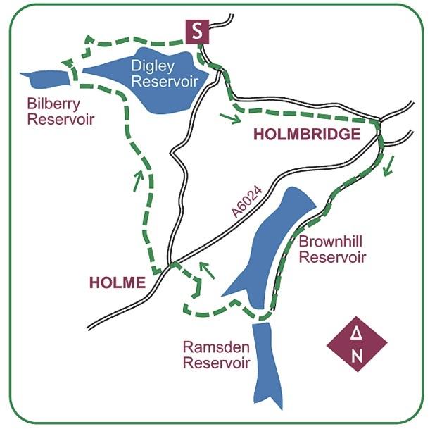
THIS WALK starts from the Yorkshire Water car park at north side of Digley Reservoir, three-quarters of a mile off the A6024 at Holmbridge.
From the car park don’t rejoin the road, but cross to information panels by an enclosed path. From a kissing-gate across it, a path descends the heathery bank above the reservoir to the road.
Continue to a junction at the end of the dam. Don’t cross, but go down the road to a kissing-gate on the right.
The path parallels the road before slanting through trees to a kissing-gate and down steep steps on to an old road. Turn left into Holmbridge, emerging opposite the church.
Turn right over the bridge then left on a side road to Yate Holme. When it splits bear right on Bank Lane, becoming Brownhill Lane as it climbs to a junction.
Keep straight on past several houses to the dam of Brownhill Reservoir, then on to approach Ramsden Reservoir.
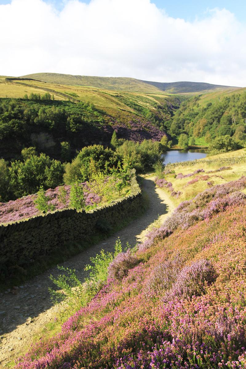
Approaching the Ramsden dam, bear right down an enclosed path to cross the dam above Brownhill Reservoir. At the end the path slants up through trees, ignoring lesser branches left to gain a knoll on the spur between Brownhill Reservoir’s arms.
It curves round above the wooded bank until dropping to a footbridge above a waterfall on Rake Dike. Slanting back up the other side the path levels out of the trees, then across a small pasture to stiles at the top corner.
An enclosed path rises to a bridle-gate, then up the other side of the wall to a gate by a house set largely below ground.
An enclosed track rises onto the A6024 on the edge of Holme. This historic settlement includes the Fleece Inn, all within the Peak District National Park.
Turn left to the square, then up through it and along Meal Hill Road. As it bends left to rise towards the school, turn right through a gate and along a grassy way.
Follow the contour across the field to a stile at the foot of the opposite wall, then continue above a wall. The path crosses a string of pastures linked by stiles, occasionally slanting right as Digley Reservoir gains prominence.
At the end the path drops right onto a broad path. Turn left through a bridle-gate, and rising away, it soon takes another in the adjacent wall into an open tract near the reservoir. The path drops to its head, which is the embankment of Bilberry Reservoir.
Back in 1852 a cloudburst on the moors burst this dam and a torrent raced down valley to Holmfirth, claiming 81 lives. Across it a track slants away, doubling back right up to a junction on open ground.
Turn right to run on into trees, later narrowing to a footpath above trees enclosing Digley Reservoir. It rejoins a track to rise past an old quarry to the start.
• This walk is taken from Paul’s book Walks For All Ages – West Yorkshire by Bradwell Books (£4.99).


Comments: Our rules
We want our comments to be a lively and valuable part of our community - a place where readers can debate and engage with the most important local issues. The ability to comment on our stories is a privilege, not a right, however, and that privilege may be withdrawn if it is abused or misused.
Please report any comments that break our rules.
Read the rules here