

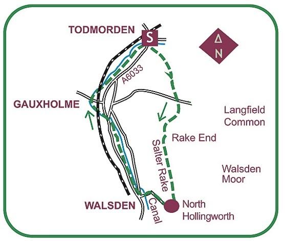
A TOWN centre start leads to a moorland skyline in this valley and hillside walk.
From the central roundabout first admire the Town Hall, with its marble figures stood above tall columns.
Leave by heading south on the Rochdale road to Fielden Square, bridging the Rochdale Canal en route.
Cross the side road leading to Honey Hole Road: rising steeply away, it jinks beneath the tall-spired Unitarian Church, climbs past the houses of Honey Hole and then a sharp kink takes it above the churchyard.
With a grassy centre it pulls steeply up to some cottages. The unsurfaced continuation bears left, more gently now between walls.
Ahead is the moorland skyline of Langfield Common, while on the right you pass a Quaker burial ground.
When the track turns sharp left exactly as Stoodley Pike monument appears on the left skyline, instead rise up an enclosed path straight ahead, emerging via a stile into a field.
Ascend the wallside onto a moorland road, and straight across rise again onto an enclosed path that rises round the side of a house.
At the other side it resumes as a splendid stone causey rising to a gate onto Langfield Common.
A grassy track rises gently right, with massive views over the moors surrounding Todmorden. Curving left it attains the walk’s summit at a cairned cross-paths at Rake End.
Here you join the Salter Rake, a packhorse route used for bringing salt across the Pennines from Cheshire.
Turn right on its gentle slant down the moor, with stone flags soon appearing as you look down on Walsden’s steep-sided valley.
This grand stride ultimately enters walled confines at North Hollingworth. Joining a driveway at this little hamlet, advance briefly to a junction.
With a white-walled old house ahead, go right on the access road’s steep descent to Walsden. At the bottom, a house dated 1805 was the residence of scientist Sir John Cockcroft.
Passing St Peter’s Church it runs on to meet the Rochdale Canal. Across it turn right on the towpath, which is traced all the way back.
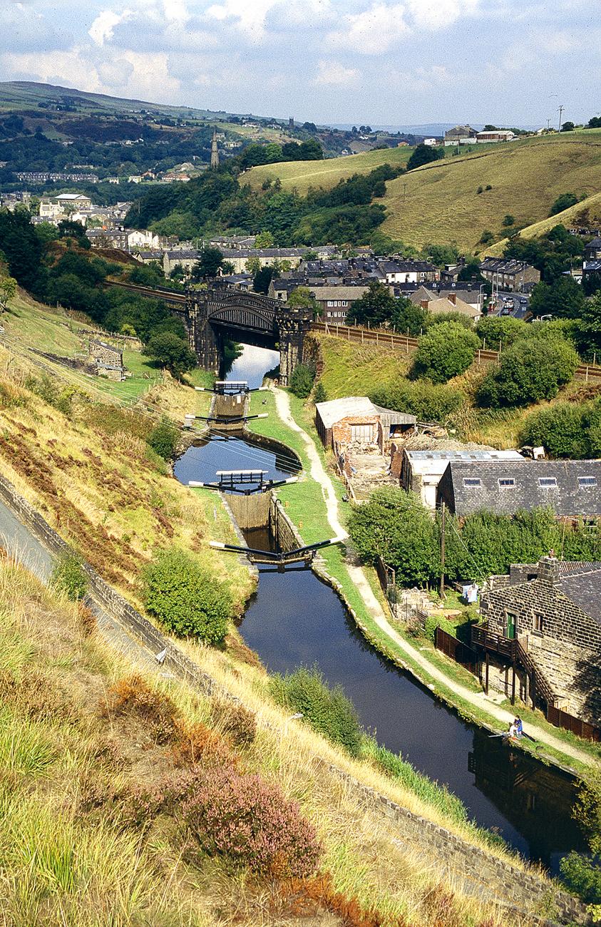
The Rochdale Canal was completed in 1804, running 33 miles between Manchester and the Calder and Hebble Navigation at Sowerby Bridge. Interest along the way includes many locks, and Walsden Water runs parallel for some time.
The only break comes when the main road intervenes: you must rise to cross both it and the canal before resuming on the opposite bank.
An aqueduct carries the canal over the beck, then approaching the Bacup road you pass under a rail bridge alongside the Gauxholme arches: the Masons Arms is just to the right.
Continuing under the road the railway soon crosses back above, and nearer the end an enormous brick wall opposite supports the railway.
Here you curve round to rejoin the road on which you began alongside the intriguing Library Lock, whose vertical bottom gate permits boats’ access beneath the main road.


Comments: Our rules
We want our comments to be a lively and valuable part of our community - a place where readers can debate and engage with the most important local issues. The ability to comment on our stories is a privilege, not a right, however, and that privilege may be withdrawn if it is abused or misused.
Please report any comments that break our rules.
Read the rules here