
TO the west of Pateley Bridge is some really interesting countryside. Here the lovely, largely quite, scenery combines with industrial history and the remnants of a thriving 18th and 19th century leading industry.
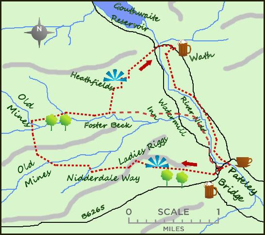
From the centre of Pateley Bridge cross the road bridge over the River Nidd heading west before climbing up the road for 200 metres to a track heading up to your right. This is part of the Nidderdale Way. Take this track and follow it in a westerly direction as it climbs on to the higher moors.
The views over Ladies Riggs from here are impressive, I like to think this was one of those beauty spots that Victorian ladies took to on their weekly Sunday walk. After half a mile through open fields the footpath meets a lane, still part of the Nidderdale Way.
Continue following the lane to the west for a mile as it initially climbs then drops to a small stream, climbs again to a second river, Brandstone Beck. The high land to the right is the Nab, a good viewpoint if the fancy the short but rough moorland scramble.
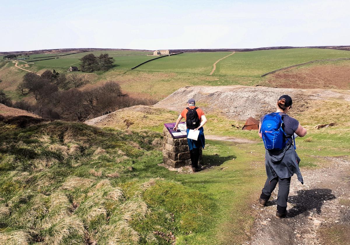
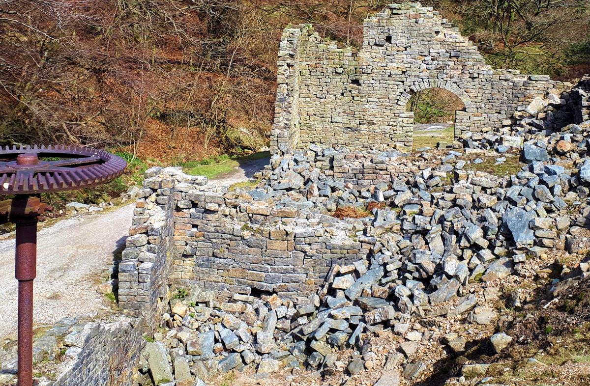
Between Brandstone Beck and Ashfold Beck/river are the remains of a once thriving lead mining industry. Mining has been practiced here since Roman times, but it was not until the 19th century, when the mines were producing up to 200 tonnes of lead a year, that Pateley Bridge really prospered.
Sticking to the Nidderdale Way, the walk passes through a churned up landscape of spoil heaps, machinery and the remains of the smelting mill on the hillside.
After arriving at the bridge crossing Ashfold Side Beck, the tracks returns to an easterly direction, in effect circling the higher Nab to your right. The track leads through a large, but not unpleasant caravanning and camping site signifying the change from industry to tourism as the driver for the economy (along with agriculture of course).
There is a direct route here back to Pateley Bridge (marked on the map) and this does have the advantage of passing next to the Watermill Inn, a mill which produced linen as recently as the 1960s (when it was known as Foster Beck Mill) and still as the water wheel.
However, my preference is the climb the steep slopes to the north on a footpath near Low Wood and leading to the excellent viewpoint near Heathfield House. The footpath leaves the Nidderdale Way track just beyond some woodland and opposite a group of cottages.
It is one of the classic occasions where the rewards outweigh the efforts, the views over Gouthwaite Reservoir and towards the Upper Nidd are wonderful. Rumour has it that this lovely area was rejected as an extension of the National Park authority due to these man made intrusions. The area is designated as an area of Outstanding Natural Beauty which does at least offer some degree of protection.
From Heathfields take the footpath a 100m to the south of the driveway that heads down and east towards the pretty hamlet of Wath. From here rejoin the Nidderdale Way and return along the River Nidd to Pateley Bridge.
Fact Box:
Distance: Roughly 7 miles.
Height to Climb: 280m (900 feet).
Start: SE 157656. There is a small car park on the east side of the river, just in the village.
Difficulty: Medium. Two steep but relatively short climbs but the walk is on good paths and tracks.
Refreshments: Pateley Bridge has a choice of pubs and cafes.
Be prepared: The route description and sketch map only provide a guide to the walk. You must take out and be able to read a map (O/S Explorer 298) and in cloudy/misty conditions a compass. You must also wear the correct clothing and footwear for the outdoors. Whilst every effort is made to provide accurate information, walkers head out at their own risk. Please observe the Countryside Code and park sensibly.
Jonathan runs Where2walk, a walking company based in the Yorkshire Dales:
• He has published 3 books on walking in the Dales; ‘The Yorkshire 3 Peaks’, ‘The Dales 30’ mountains and the ‘Walks without Stiles’ book. All these books (and more) are available direct from the Where2walk website.
• Climb the 3 Peaks in 3 Days (Yorkshire version) Sept 6/7/8th
• Book a Navigation (Map and Compass Skills) Training day near Settle (next date Sept 2nd). All dates and details are on the Where2walk website.
Where2walk.co.uk also features 100’s of walks across Yorkshire and beyond, from easy strolls to harder climbs.


Comments: Our rules
We want our comments to be a lively and valuable part of our community - a place where readers can debate and engage with the most important local issues. The ability to comment on our stories is a privilege, not a right, however, and that privilege may be withdrawn if it is abused or misused.
Please report any comments that break our rules.
Read the rules here