
THE medieval deserted village of Wharram Percy is set down dale in the heart of the Yorkshire Wolds. It’s a peaceful place and best accessed via the walk over the chalk wolds from the lovely village of Thixendale.
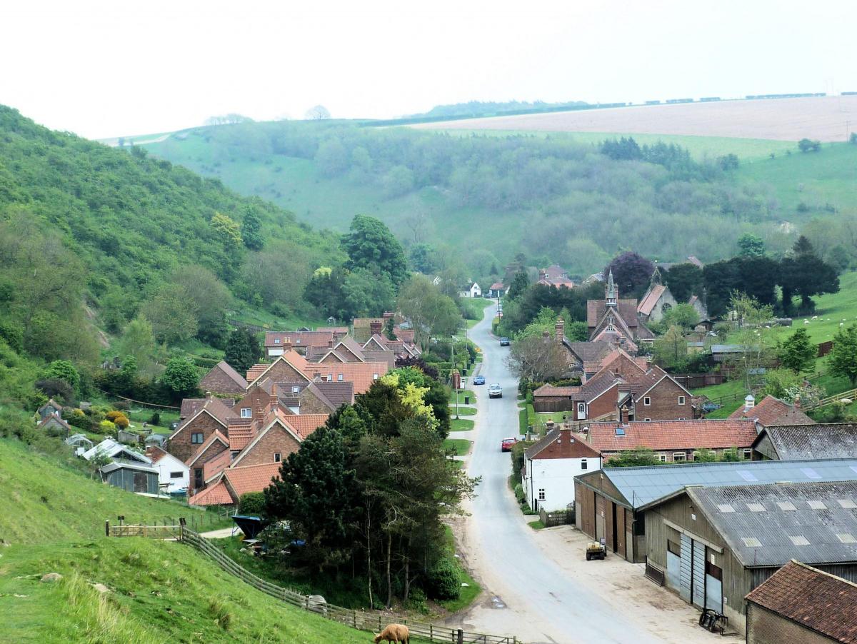
Thixendale is a delightful village, tucked between a variety of intersecting chalk valleys. Among its highlights are the lovely St Mary’s Church and an excellent pub, the Cross Keys.
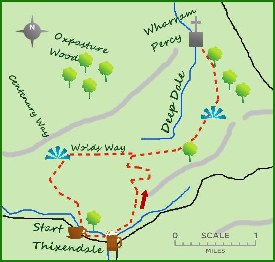
Park in the centre of the village and head north east on the path opposite the pub. This is Water Dale but after 400m the path bends north (to the left) into a second steep-sided dale, Court Dale. A steep climb takes you away from the valley floor to its eastern rim. Here the views down dale and across the countryside so typify the chalk landscape of the Yorkshire Wolds.
The most intriguing aspect of the valleys is they are almost inevitably dry, despite the steep slopes. The valleys themselves were created at the end of the last ice age, 15,000 years ago, with fast running water creating deep valleys on the frozen ground.
However, being on a chalk bedrock means the normal streams drain away leaving a unique and almost uniformly dry landscape. Unusual! The path follows the crest of the valley north for 500m then cuts east and steadily uphill for 300m before joining a farm track and continuing north till it meets the Yorkshire Wolds Way.
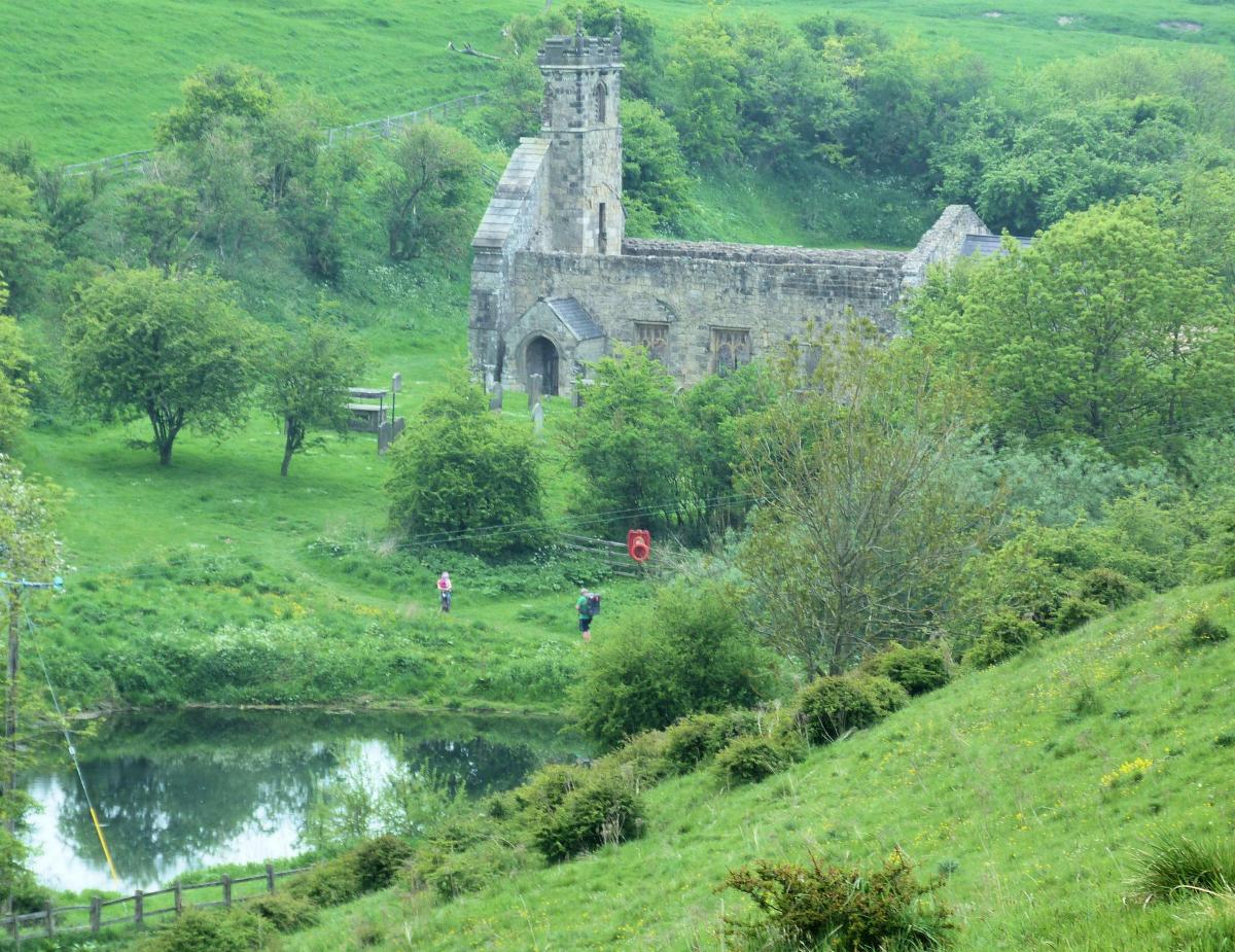
Turn right and follow the Wolds Way for a few hundred metres to come woodland. The path carries alongside the woods overlooking (to your left) another deep dale, conveniently called Deep Dale. Where the path divides take the left fork. Heading north the church at Wharram Percy appears in the distance. The Wolds Way drops towards the church and in to the deep valley.
Wharram Percy is an exceptionally interesting and well researched ruined medieval village. There has been much excavation undertaken concerning the village which thrived between the 9th and 15th century. The church has survived better than anything, but the remains of houses and other building can be seen and are worth an explore.
Return via the same route to the head of Deep Dale, but to vary the end of the walk carry on westwards past a small set of woodland on your left for three-quarters of a mile. The deep valley to your right has become much shallower. At a junction of paths turn left and follow the Yorkshire Wolds Way south as it drops and climbs steeply out of Valley Pasture Dale. From here the path turns in to wider track. The track soon emerges, past some earth workings on your left at the head of the valley with Thixendale at its foot. The track down creates one of the most picture perfect scene in Yorkshire.
Fact Box:
Distance: Roughly 7 miles.
Height to Climb: 190m (610 feet) Start: SE 845611. Park conveniently in the village, best near the pub.
Difficulty: Medium. The climbs and descents are all steep but the route is very uniform.
Refreshments: The Cross Keys in Thixendale is small but full of character.
Be prepared: The route description and sketch map only provide a guide to the walk. You must take out and be able to read a map (O/S Explorer 294) and in cloudy/misty conditions a compass. You must also wear the correct clothing and footwear for the outdoors. Whilst every effort is made to provide accurate information, walkers head out at their own risk. Please observe the Countryside Code and park sensibly.
Jonathan runs Where2walk, a walking company based in the Yorkshire Dales:
• He has published 3 books on walking in the Dales; ‘The Yorkshire 3 Peaks’, ‘The Dales 30’ mountains and the ‘Walks without Stiles’ book. All these books (and more) are available direct from the Where2walk website.
• Join us for a walk up Pen-y-Ghent (6 Sept), Whernside (7 Sept) and Ingleborough (8 Sept).
• Book a Navigation (Map and Compass Skills) Training day near Settle (next date Sept 16th). All dates and details are on the Where2walk website.
Where2walk.co.uk also features 100’s of walks across Yorkshire and beyond, from easy strolls to harder climbs.


Comments: Our rules
We want our comments to be a lively and valuable part of our community - a place where readers can debate and engage with the most important local issues. The ability to comment on our stories is a privilege, not a right, however, and that privilege may be withdrawn if it is abused or misused.
Please report any comments that break our rules.
Read the rules here