
Jonathan Smith runs Where2walk, a walking company in the Yorkshire Dales. Jonathan has written his own book, the Dales 30 which details the highest mountains in the Dales. He also runs one-day navigation courses for beginners and intermediates. Join his Learn a Skill, Climb a Hill weekends in the Dales. To find out more details on any of the above visit his website, where2walk.co.uk
THE lovely countryside in Upper Swaledale is always worth exploring.
On this walk up Rogan’s Seat there a contrast from the pretty lower slopes, full of interest and the long moorland walking towards the summit of this, the most northerly of the Dales 30 mountains.
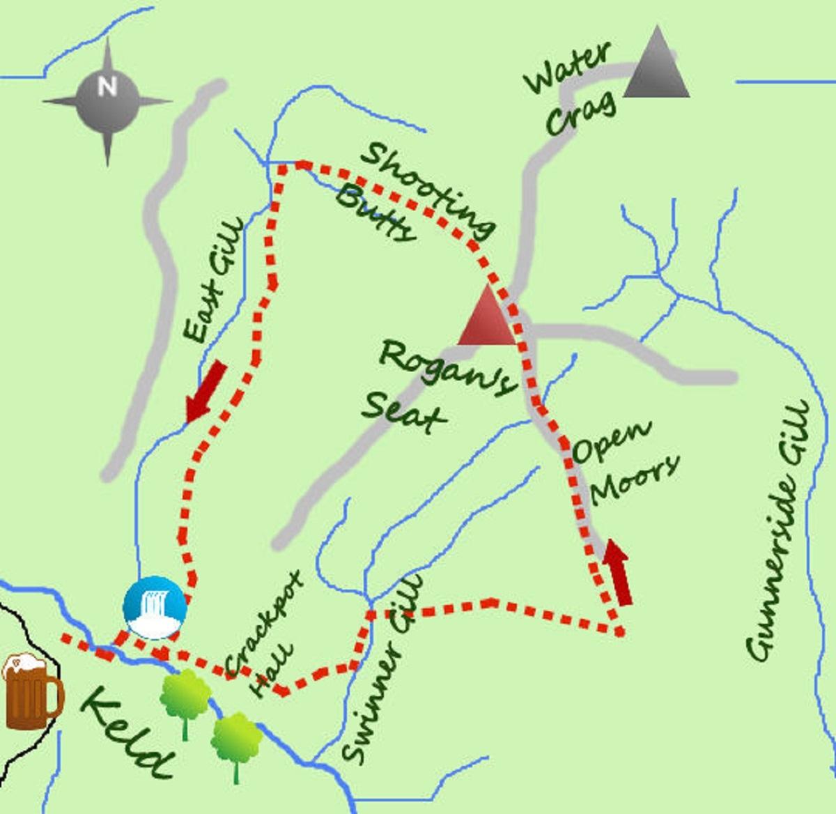
There is parking in Keld. Take the bridleway next to the church for 200 metres heading SW (above the river on your left). Turn left and drop to cross the embryonic River Swale and right to join the Pennine Way.
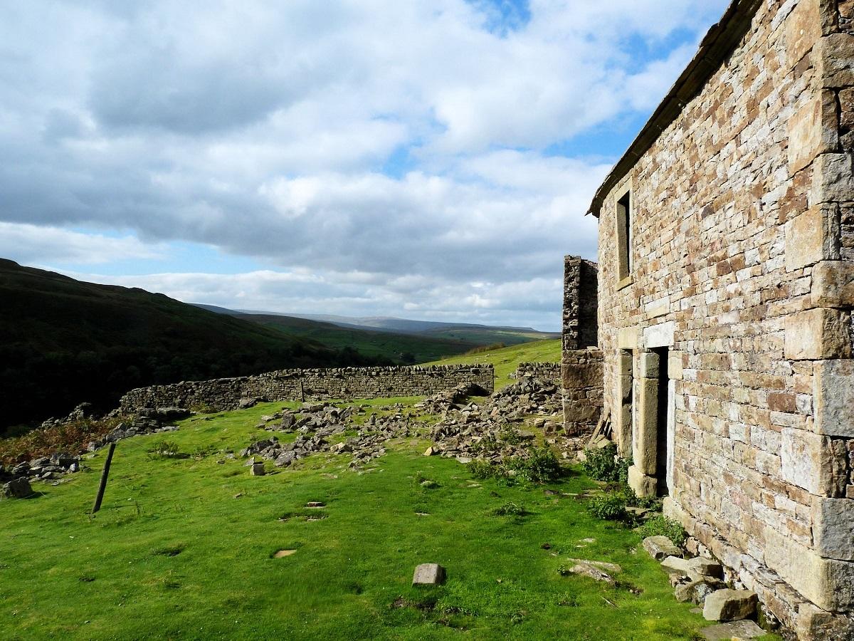
Within 200 metres is Kisdon Force, an impressive waterfall, particularly after heavy rain and continue along the main track for half a km. A footpath now leaves the track, forks left and passes through the remains of Crackpot Hall, a two-story house of legend and mystery.
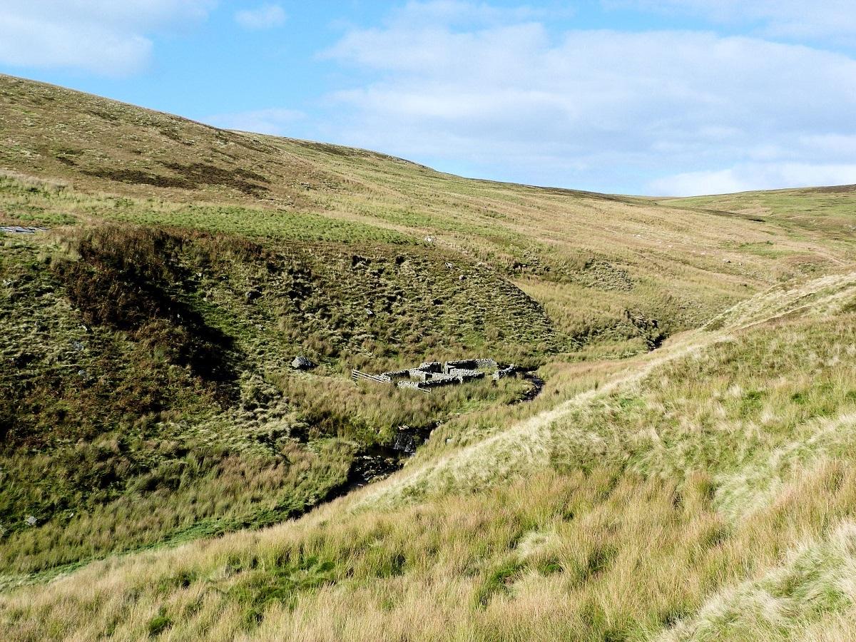
After Crackpot Hall the path bends NNE to remain high above Swinner Gill (ahead and to your right), before dropping to a footbridge after a quarter of a km. The path now heads east alongside East Grain, passing some disused mining buildings, before climbing steeply out on to the moors.
The mountains and hillsides of Swaledale are rich in history. Lead mining transformed the landscape and today the bare rough slopes, ruined buildings and mines bear testament to rugged times in the 19th century. Swinner Gill is a very good example of this, Crackpot Hall was used at its core with the steep sided gill perfect for the thousands of miners to dig the precious lead from the hills. Above the gill join a landrover track on the moors and follow for a further half mile to a gate and fence. Just past here the track divides, turn north (left) and follow the track for over a mile past some shooting butts and a small lodge to the high point. A small summit cairn is 100 metres on the left perched on a peat hag.
The name Rogan’s Seat is over 1,000 years ago and of Norse origin and apparently means Rogan’s Upland Pasture. This is typical of Swaledale where places are names after people of times yore. There are also a number of seats but these are spread through the Dales and include Lovely Seat, Citron Seat and Simon’s Seat.
Return to the track and continue north through a gate before turning west. The ‘road’ finishes in a turning circle, carry on along a rutted track past more shooting butts. After the last butt the tracks become less used and rutted. Just prior to reaching East Gill the path turn south (left) and start to contour the stream. The path is intermittent but keep to the contour (the stream becomes further away as it falls through a steep sided ravine). After one and a half miles cross a fence and as a second fence is approached the path drops steeply and passes under the fence. From here the path is more clear, eventually passing through a gate and through a field back to the bridleway above the River Swale. Keld is barely 10 minutes walk from here.
* Fact Box:
Distance: Roughly eight miles
Height to Climb: 430m (1410 feet)
Start: NY 892011. A small car park is in the centre of the village.
Difficulty: Hard. The walk is on good tracks till the return. Here the path is intermittent and rough.
Refreshments: The take away café may be open in the centre if Keld but Keld Lodge serving food and drink is.
Be Prepared:The route description and sketch map only provide a guide to the walk. You must take out and be able to read a map (O/S Explorer OL30) and in cloudy/misty conditions a compass. You must also wear the correct clothing and footwear for the outdoors. Whilst every effort is made to provide accurate information, walkers head out at their own risk.


Comments: Our rules
We want our comments to be a lively and valuable part of our community - a place where readers can debate and engage with the most important local issues. The ability to comment on our stories is a privilege, not a right, however, and that privilege may be withdrawn if it is abused or misused.
Please report any comments that break our rules.
Read the rules here