
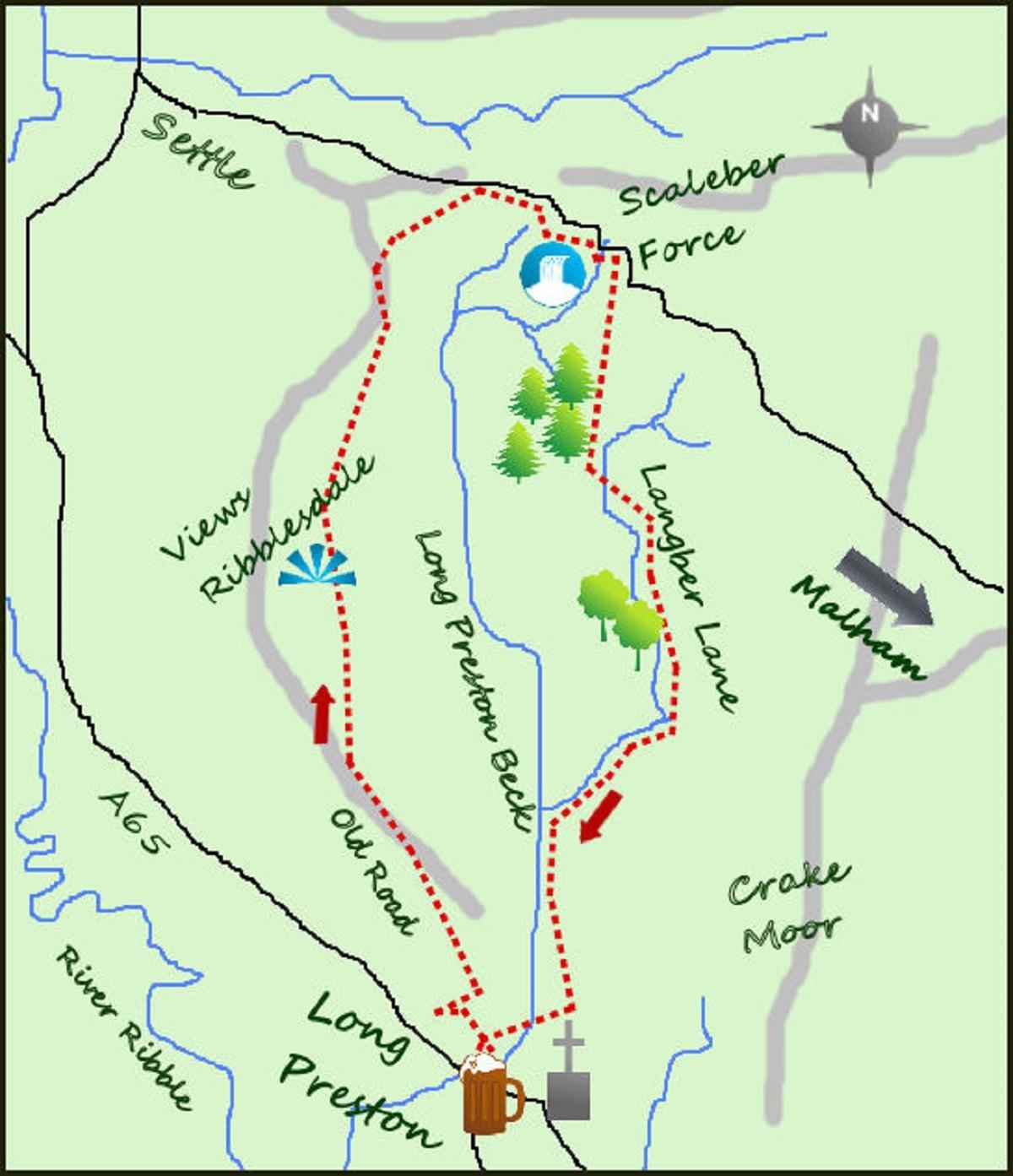
A STRAIGHTFORWARD walk along the lanes that separate Settle and the nearby village of Long Preston.
The walk is along country lanes and tracks amidst stunning and rarely visited Yorkshire Dales scenery. Add in the pretty waterfall of Scaleber Force.
The village of Long Preston lies astride the A65 between Skipton and Settle and is a quiet but interesting village. St Mary Church and large graveyard are certainly worth a visit.
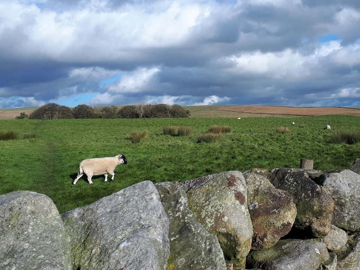
From the Maypole head away from the A65, past the pretty primary school and along a tarmacked lane heading just north of east. The tarmac runs out at a farm to your left but carry on to cross Long Preston beck via a small footbridge. Turn left and head alongside the river (the strange circular wall above is the Long Preston reservoir!) through fields of sheep for nearly half a mile. Where the land opens up cross a footbridge and start to veer away from the river to the right, through a kissing gate and on to a footpath which climbs steadily north east for over half a mile.
After two gates and a broken wall the path follows a stream on your right as the path bends left. Cross the stream over some rough stepping stones and arrive on Langber Lane. Turn left on to the lane and follow this for two miles. There is a considerable amount of tree planting to the left as you walk, this is part of the efforts to bring more mixed woodland to the Yorkshire Dales. Not only is it natural and attractive but trees help retain water in the soils and reduce flooding further down the valleys by regulating water flow after heavy rains.
The newly planted mixed woodland becomes more traditional forestry as you approach the main road from Settle to Malham. The views ahead to the limestone Attermire Scar are wonderful.
On meeting the main road turn left and almost immediately the road crosses a steep sided stream. After crossing the bridge turn immediately left and a small wooded path leads to Scaleber Force. This attractive series of waterfalls are some of the most beautiful in the Dales. Return to the road and follow it for just over a quarter of a mile to a lane on the left. Follow this lane with dry stone walls on either side for half a mile until it emerges high above Settle, meeting the old road from Settle to Long Preston.
Turn left and follow the ‘old road’, unsuitable for anything but farm vehicles over to Long Preston. The return route is nearly three miles but full of interest.
The views are particularly impressive. To the right Ribblesdale and the Forest of Bowland are laid out with the distinctive shape of Pendle Hill in the distance, whilst to your left the moors stretch out for miles. The other distinctive hill to your left is Rye Loaf, rarely visited.
For the final mile the lane drops steadily down towards Long Preston, arriving at Maypole Green. The maypole is used for Mayday dancing once a year by the children of the school, a lovely tradition and a reflection of this often ignored but always enjoyed village.
Fact File:
Distance: Roughly eight miles
Height to Climb: 280m (920 feet).
Start: SD 834583. There is parking around the village green but please be considerate.
Difficulty: Moderate. It is quite a long walk but mainly on excellent tracks or lanes so the miles do go quickly.
Refreshments: The Maypole is presently closed but the Boars Head is open from roughly 4.30pm.
Be Prepared: The route description and sketch map only provide a guide to the walk. You must take a map (O/S Explorer OL2) and in cloudy conditions a compass.
* Jonathan Smith runs Where2walk, a walking company in the Yorkshire Dales. He has written his own book, the Dales 30, which details the highest mountains in the Dales. He also runs one-day navigation courses for beginners and intermediates.
Join his Learn a Skill, Climb a Hill weekends in the Dales. Visit where2walk.co.uk


Comments: Our rules
We want our comments to be a lively and valuable part of our community - a place where readers can debate and engage with the most important local issues. The ability to comment on our stories is a privilege, not a right, however, and that privilege may be withdrawn if it is abused or misused.
Please report any comments that break our rules.
Read the rules here