
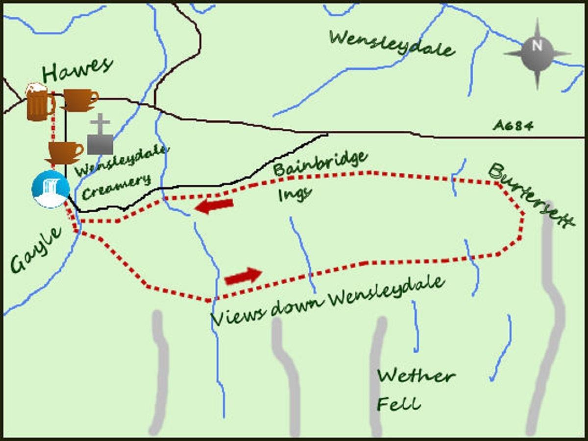
MOST would assume that a short walk from Hawes would lead to Hardraw Force.
However, this walk does not but leads along the flanks of Wether Hill to the pretty village of Burtersett. The views down Wensleydale are some of the best in the Dales, particularly in a low winter light.
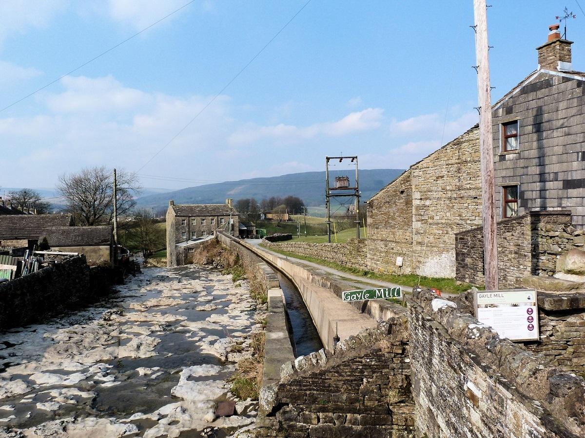
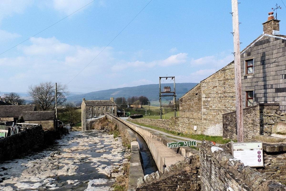
From Hawes walk to the west end of the town and turn south (left towards the hills) along a road which passes the Wensleydale Creamery centre. Carry on past Gayle Mill and into Gayle itself.
The mill, which is not presently open to the public, generated electricity for a small corner of Hawes 100 years ago. It was driven by the powerful water descending from the slopes of Wether Fell. Where the road meets a T junction turn left over the bridge and then immediately right, over a stile and on to a sloping field. Aim for the far corner of the field where there is another stile leading in to a further field, climbing gradually.
The path continues south east, crossing two more stiles before turning more in an easterly direction and contouring the hillside (this Wether Hill, climbeable if you take the path heading directly uphill). A leisurely walk through the fields gives ample opportunity to enjoy the lovely views ahead and down Wensleydale. The winter light accentuates the soft valley sides, isolated farm buildings, barns and intermittent copses of woodland. They combine to give Wensleydale the gentler image than that of its neighbours (Swaledale and Wharfedale) but it is none the worse for it.
Soon the paths turn in to a lane, Shaws Lane, on the approach to the lovely village of Burtersett. The village has a long and distinguished history, initially through farming but with some mining during the 19th century, going back to the Norman Conquest. However I was most interested to find that the first man up Everest, along with Sherpa Tenzing, St Edmund Hillary, had descendants from nearby Hillary Hall!
It is still an attractive village with lovely stone buildings and well worth closer exploration.
Return via the fields directly west of Burtersett. You will find the first stile next to a signpost in the centre of the village and from there the path goes initially down hill before joining a path from the right and heading due west. A number of fields are crossed but the views ahead over Hawes and in to Upper Wensleydale are once again excellent.
After crossing through a small campsite (and country park) at Bainbridge Ings the path meets a quiet road which leads back in to Gayle. After the bridge turn right past the mill and back to the Wensleydale Creamery. Cheese making here actually dates back to 1150 when Cistercian Monks first settled the area. It makes an interesting end to a fine, but short, walk.
Fact File:
Distance: Roughly 4.5 miles
Height to Climb: 100m (320 feet)
Start: SD 875899. There is a public car park at the Countryside Museum in Hawes.
Difficulty: Easy. Mainly paths in fields with stiles.
Refreshments: The Wensleydale Creamery is good but there is a choice of cafes and pubs in Hawes.
Be Prepared: The route description and sketch map only provide a guide to the walk. You must take out and be able to read a map (O/S Explorer OL30) and in cloudy/misty conditions a compass. You must also wear the correct clothing and footwear for the outdoors. Whilst every effort is made to provide accurate information, walkers head out at their own risk.
Please observe the Countryside Code and park sensibly.
* Jonathan Smith runs Where2walk, a walking company in the Yorkshire Dales:
He has published two books on the Dales, ‘The Yorkshire 3 Peaks’ and ‘The Dales 30’ mountains. Available direct from the Where2walk website.


Comments: Our rules
We want our comments to be a lively and valuable part of our community - a place where readers can debate and engage with the most important local issues. The ability to comment on our stories is a privilege, not a right, however, and that privilege may be withdrawn if it is abused or misused.
Please report any comments that break our rules.
Read the rules here