
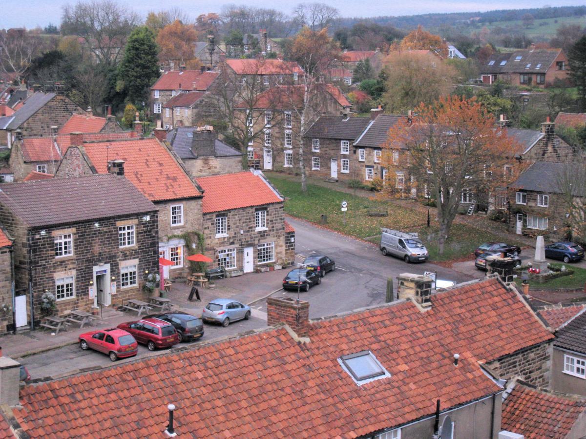
OSMOTHERLEY is the walking capital of the North York Moors (well I think so!). Normally it is a place for long distance walkers or those heading far in to the moors, but this is a shorter walk which explores the village itself and the nearby countryside.
The Coast to Coast and the Cleveland Way long distance paths pass nearby with many walkers staying in Osmotherley while the 43 mile Lyke Wake Walk starts close by.
The location of Osmotherey also makes it easy to head up on to the high moors, but this walk keeps closer to the village.
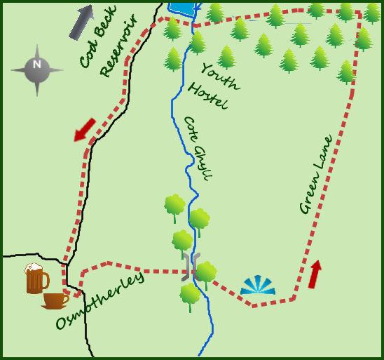
Park as near to the central square as possible (easier now, can be very busy in the summer holidays). Head south (downhill) for 50 metres from the central square and take a side road on the left which doubles back parallel heading north. After 50m the Cleveland Way heads east on a good path.
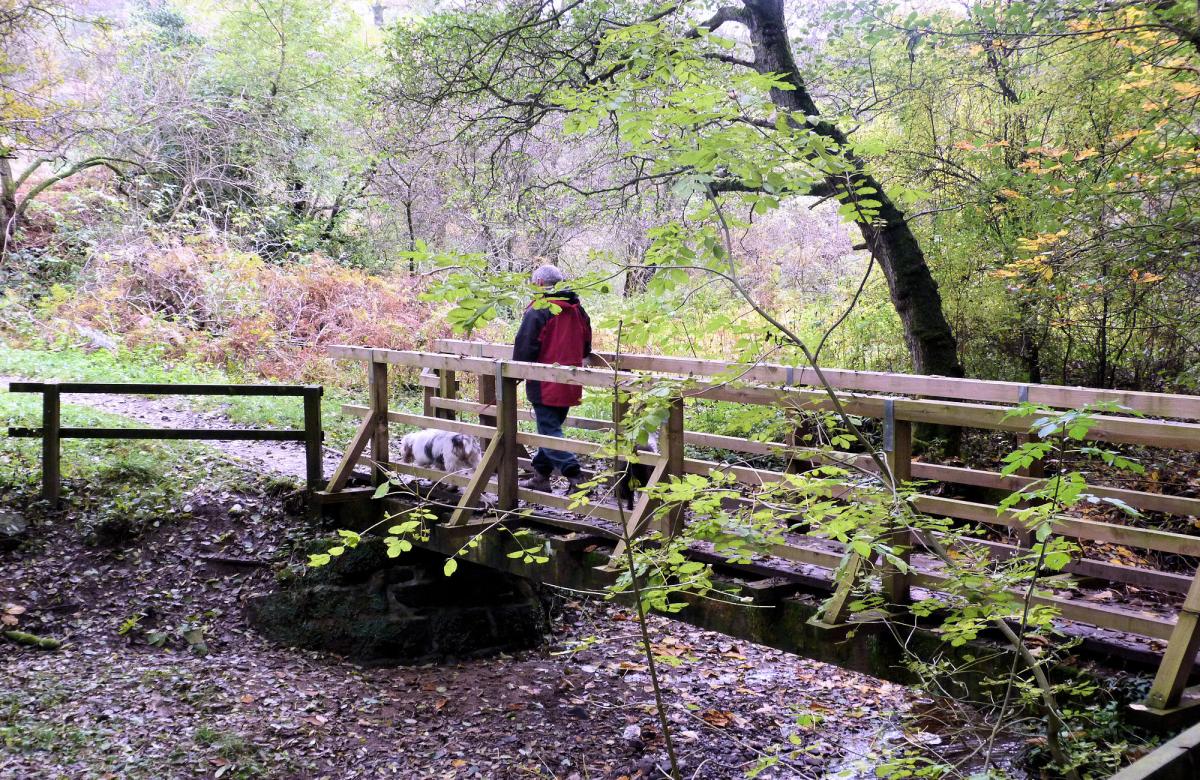
The path passes alongside some houses before dropping in to some woods and footbridge which crosses a small stream.
Cross the footbridge and climb out of the woods to a junction of paths. Ignore paths to the left and right and continue to climb east with a farm on your right.
After 300 metres the path meets Green Lane. Turn left and head north along the lane for one mile. It is easy walking. After roughly ¾ of a mile the track enters some forestry land.
I am not usually a great lover of forestry but this does not last for long and offers a good contrast to the earlier woodland.
Soon after entering the forest there is a meeting of paths, head straight on for 250 metres to a more obvious forestry track.
Turn left on to the track and follow this to the dam which crosses the southern end of Cod Beck Reservoir. Cod Beck Reservoir is a popular walking spot, the whole reservoir being man-made (previously just a stream) in 1948.
Osmotherley Youth Hostel was built here and is a popular stopping place. It is perfectly possible to extend this walk by taking the permissive path that circles the reservoir. It adds 1 ½ miles to the day’s walk.
For those keen on returning to Osmotherley cross the dam and join the quiet road heading south towards the village.
The youth hostel can be seen to the left as can a large caravan and camping site. From the reservoir the path does climb gradually before dropping as the village is approached.
Many of the houses you pass before arriving at the centre were built in the 19th century to house the workers from the growing textile industry and nearby quarries. Finish at the impressive war memorial in the centre of Osmotherley.
Fact box:
Distance: Roughly 3 1/2 miles
Height to Climb: 120m (390 feet)
Start: SE 456972. Park near the centre of Osmotherley.
Difficulty: Easy. It is an extra 1 1/2 miles around Cod Beck Reservoir.
Eat and drink: There are three pubs surrounding the war memorial and a café which opens for long weekends.
Be prepared: The route description and sketch map only provide a guide to the walk. You must take out and be able to read a map (O/S Explorer OL26) and in cloudy/misty conditions a compass (essential on this walk). You must also wear the correct clothing and footwear for the outdoors. Whilst every effort is made to provide accurate information, walkers head out at their own risk. Please observe the Countryside Code and park sensibly.
Jonathan Smith runs Where2walk, a walking company in the Yorkshire Dales:
• He has published 2 books on walks in the Dales, ‘The Yorkshire 3 Peaks’ and ‘The Dales 30’ mountains. Available direct from the Where2walk website.
• Book a Navigation Training day (Beginners or Intermediates). All dates and information on the website.
• Where2walk also run Navigation weekends in the Dales and the ‘3 Peaks in 3 Days’ guided walks. Full details also on the website
Jonathan’s popular website, Where2walk.co.uk also features 100’s of walks across Yorkshire and beyond, from easy strolls to harder climbs


Comments: Our rules
We want our comments to be a lively and valuable part of our community - a place where readers can debate and engage with the most important local issues. The ability to comment on our stories is a privilege, not a right, however, and that privilege may be withdrawn if it is abused or misused.
Please report any comments that break our rules.
Read the rules here