
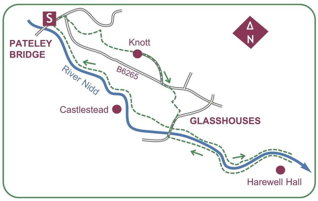
START this lovely walk from the centre of town.
From the bridge at the foot of High Street head up the main thoroughfare, swinging right at the top to level out.
After the Methodist church a path heads up a flight of steps to the start of the Panorama Walk.
A steep, enclosed path climbs past a well, and beyond the cemetery entrance turn left onto a snicket running to the old church.
Hidden in trees, roofless St Mary’s dates from the 14th century, but was replaced by St Cuthbert’s in the town.
Resume by following the path up the churchyard a few strides to a kissing-gate in the wall on the right.
A path crosses a field to a gate, and on again to a stile at the end.
A few enclosed strides lead back onto the Panorama Walk.
The gradient eases and the narrow surfaced lane continues.
Almost at once an iron gate admits to a viewing platform on a craggy knoll.
It is here that the Panorama Walk lives up to its name by looking across the valley to the silhouette of Yorke’s Folly on Guise Cliff.
Reaching the hamlet of Knott, the way widens to drop down to the main road.
Two minutes along the footway to the left, cross to a kissing-gate just past a solitary dwelling. A flagged path leads down to a second field to descend to a rough lane on the edge of Glasshouses.
Turn left a short way, then past an attractive terrace a steep flagged snicket provides a short-cut towards the river.
Glasshouses village is based around a sloping green: dominant feature is the prominent church spire.
Rejoining the road, continue down past the former station and the school to approach Glasshouses Bridge.
Turn before the bridge into the yard of Glasshouses Mill on the left, and leave by bearing right immediately after the main building.
Down its far side a track descends to the river.
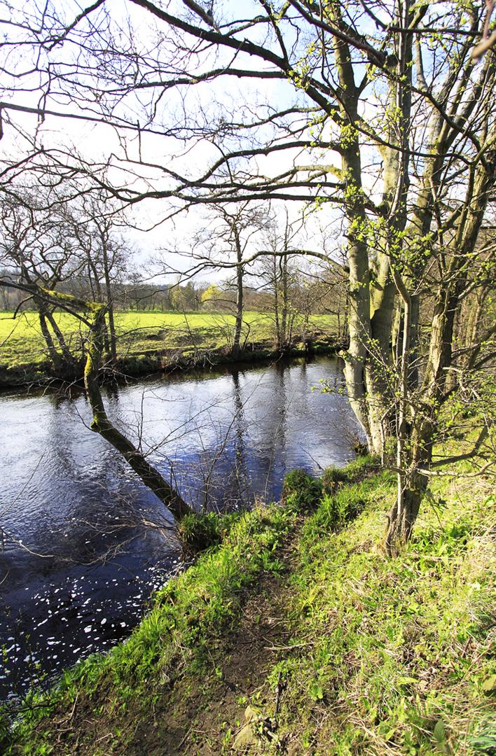
A path largely clings to its bank, apart from a slant up to a wall-stile to run briefly above, while a little further a small corner is cut by way of stiles.
The path passes under the remains of a viaduct of the Nidd Valley Railway to arrive at a wooden footbridge.
Finally cross the river and turn upstream, again clinging to the riverbank.
After another section of viaduct the path passes through a wooded bank at a bend, then a sewage works.
Open surrounds reveal Glasshouses Mill ahead, with a stile onto the road at Glasshouses Bridge.
Cross the bridge and take the broad carriageway upstream for an infallible return to Pateley Bridge.
The drive is sandwiched between a mill-cut and a large millpond before the river is regained at a weir, with the big house of Castlestead across it.
The Nidd is now traced upstream on an all-weather path to re-enter the town alongside a linear car park.
* The River Nidd is a tributary of the River Ouse. for the first few miles it is dammed three times to create Angram Reservoir, Scar House Reservoir and Gouthwaite Reservoir which attract around 150,000 visitors a year.


Comments: Our rules
We want our comments to be a lively and valuable part of our community - a place where readers can debate and engage with the most important local issues. The ability to comment on our stories is a privilege, not a right, however, and that privilege may be withdrawn if it is abused or misused.
Please report any comments that break our rules.
Read the rules here