
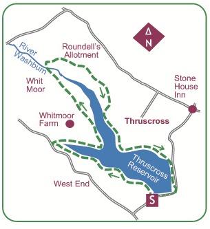

START from Thruscross Reservoir car park at west edge of dam.
Thruscross Reservoir is the highest and youngest of the four reservoirs in the Washburn Valley, its 120-foot-high dam constructed as recently as 1966.
Sacrificed was the hamlet of West End, which has since returned to daylight in times of drought.
A mile north of the start is the isolated Stone Cross Inn.
Cross the road to find a broad path down through Thruscross Woods to the reservoir.
This runs an unbroken course along the bank, soon reaching the submerged West End-Thruscross road: trace it uphill a few strides to a footbridge to resume.
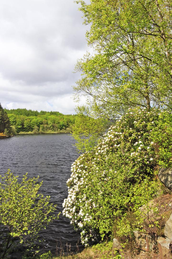
Further, the reservoir’s western arm passes a ruined mill.
Its waterwheel socket is still evident, and beyond it you trace the course of the leat that supplied it.
The feeder stream of Capelshaw Beck leads out to a stile onto a road.
Without joining it the path runs right to a footbridge, then up a verge to turn right through a gate.
This new path traces the other side of this western arm beneath Whitmoor Farm, initially looking across at the mill before entering trees.
Part way along, just past the intriguing ruin of Holme Field Head in the adjacent field, you reach a stile on the left.
Here leave the concession path and turn right outside the forest fence to a stile/gate onto Whit Moor.
A path runs along the fenceside, and part way on merges with another at a guidepost to your left.
This runs on to a stile by a gate to drop to a seat on the forest corner, overlooking the valley.
A steep path outside the trees drops to a bridge on the River Washburn.
This fine little beck draining the moors is currently unaware of what awaits it in the next few miles!
Over a stile you stay in open country, beginning with a short climb to a bouldery knoll at the plantation corner.
The path then rises more gently away across Roundell’s Allotment.
Beyond the plantations hiding the reservoir, moorland skylines lead from Rocking House to the Great Pock Stones. Intermittent marker posts see the path across the moor to pass beneath a small boulder cluster on a knoll.
Over a stile/gate you enter heather moorland, a delightful section that ends all too soon.
Back among bracken, and with the reservoir re-appearing, a broad grassy path drops right to a ladder-stile at the plantation corner.
Steps drop you steeply by the trees to a path running left beneath sheep pastures above the lake.
Further on it drops to the shore, swinging left at a promontory where the dam appears ahead.
After an inner corner it re-crosses the old road met earlier, and resumes along the shore until masked by trees.
It continues parallel with a road until joining it: turn right past Thruscross Reservoir Lodge to the east end of the dam.
Cross the dam road to finish, with steps at the end up into the car park.


Comments: Our rules
We want our comments to be a lively and valuable part of our community - a place where readers can debate and engage with the most important local issues. The ability to comment on our stories is a privilege, not a right, however, and that privilege may be withdrawn if it is abused or misused.
Please report any comments that break our rules.
Read the rules here