
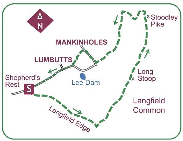
START this walk from the Shepherd’s Rest Inn a short mile west of Lumbutts. Roadside parking.
From a gate opposite the pub a broad path bears left across the moorland of Langfield Common.
Immediately crossing a flagged packhorse route, a minute further a fork is reached: keep to the gentler left branch to rise steadily across the moor.
The path rises ever gradually beneath shapely rocks and scars of long abandoned quarrying on the cliffs of Langfield Edge.
Your improving path is carried across the embankments of two old dams.
Eventually this splendidly engineered way gains the far end of the brooding rocks, then a path contours around the head of deep-cut Black Clough.
Doubling back across the far side, it is now set back from the clough.
The path remains clear as it bears right and commences a gentle rise enhanced by a rash of boulders.
As the slope tails off so do the rocks, and the path skirts the mound of Coldwell Hill on your right.
Faced with a group of boulders the path drops gently right to merge with the Pennine Way.
Bear left on its part-flagged course past a memorial seat on a short stony drop to a dip.
Ignoring an early lesser branch curving right, rise to a crossroads with a paved way.
This junction is overseen by the Long Stoop guidepost.
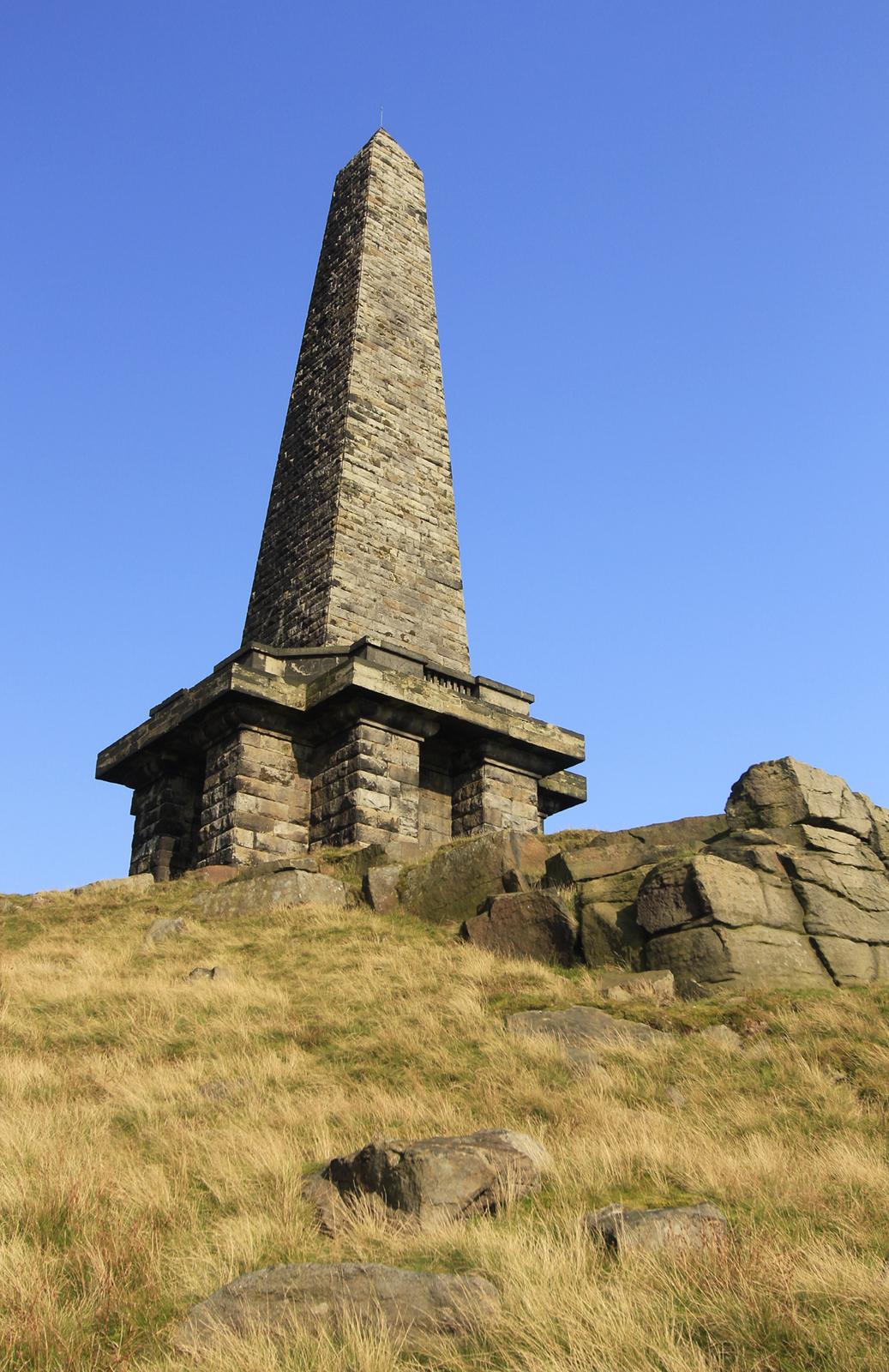
Your path advances straight on, rising past boulders and an old quarry to follow a broad, level course past clusters of rocks to the Stoodley Pike monument.
Erected in 1815 to celebrate peace after victory over Napoleon, it later collapsed and was replaced by a new tower in 1856.
A spiral staircase climbs to a viewing balcony on this popular Calderdale landmark.
Leave by a broad path departing the edge just a few yards west of the monument. This drops briefly away then slants left across the steep slopes, before long turning sharp right, and forking.
Take the right option, dropping down a short groove to merge with another path, and go right down this to drop pleasantly onto a broad, firm bridleway along the foot of the moor, above the modern housing of Harvelin Park.
Turning left, it runs a largely level course beneath steep slopes, and unfailingly along to eventually reach a corner. Through the gate ahead a walled track runs on to drop down to the edge of Mankinholes.
Turn right through this old handloom weaving settlement, noting the water troughs.
Beyond the last buildings you reach a former Wesleyan Methodist Sunday School and burial ground.
Turn left down paved Lumbutts Lane to the Top Brink Inn at Lumbutts.
With the pub to your left, go straight ahead down an enclosed, setted path onto the road by a former water wheel tower.
Turn right through the hamlet and head along the long, rising road back to the start, en route note a sundial of 1864.
This walk is found in Paul’s book Walking in Yorkshire – Calderdale & South Pennines (£5.99)


Comments: Our rules
We want our comments to be a lively and valuable part of our community - a place where readers can debate and engage with the most important local issues. The ability to comment on our stories is a privilege, not a right, however, and that privilege may be withdrawn if it is abused or misused.
Please report any comments that break our rules.
Read the rules here