

Robin Longbottom retraces the route of a long-forgotten highway between Keighley and Settle
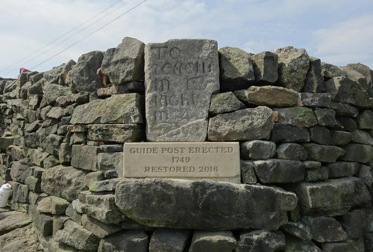
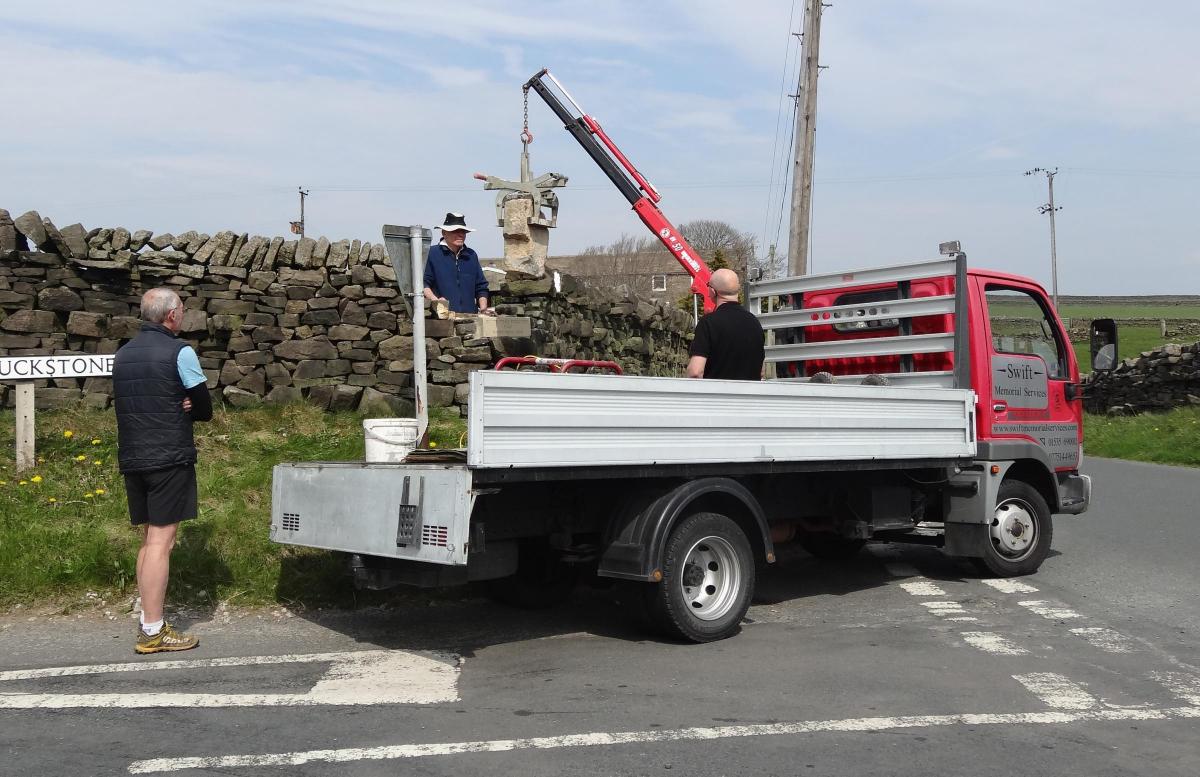
IN 2016, the top half of a broken guide post was found in a garden wall at Four Lane Ends Cottage, Aden, above Sutton-in-Craven.
Permission was given by the owner for it to be removed with a view to restoring it to the adjacent crossroads. A small group of friends undertook the work, and it was later relocated to a prominent position in a wall on the crossroads.
In 1697, an Act of Parliament had been passed that required justices of the peace for the county to erect signposts at crossroads and road junctions to guide travellers across open land and moor. The posts were to be erected only along highways to indicate the directions and the distance to the market towns they led to. The one at Four Lane Ends was erected in 1749 and may well have replaced a previous wooden one. What is most surprising today about the guide post is that it marked the route of a now long-forgotten highway between Keighley and Settle. A hand with a pointing finger indicates 'To Kighley 4 m' and on the same face one pointing in the opposite direction 'To Settell'. The direction to Colne was indicated on the back – 'Cown 6 m'.
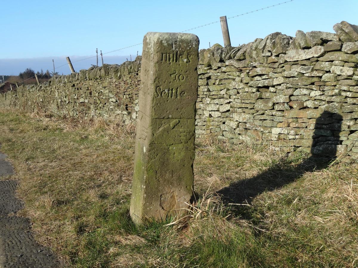
The route to Four Lane Ends left Keighley along old Westgate and passed through Braithwaite and Laycock to Green Syke, from where it went along Pole Road. From Four Lane Ends it ran below Sutton Pinnacle to Lane Ends at Cowling where it crossed Ickornshaw Beck and Carr Head Lane. At the point that it crossed Carr Head Lane, and now largely obscured by a thick hedge, stands another guide post. This too indicates the direction to Settle, pointing along Leys Lane to the crossroads at the top of the Lothersdale Road, Cross Hills. Here another guide post once stood but is now missing. However, some 500 yards along the route is yet another post, now used as a gate stoop. It appears that there was once a road junction here. The guide post indicates the direction for Keighley and Settle, and also gives one for Thornton-in-Craven. The former highway to Thornton no longer exists but today remains as footpaths, enabling the old route to be walked if desired.
The road now passes over Carlton Moor where it crosses the old highway from Skipton to Colne, before descending into Elslack. At this crossroads stands another guide post, known locally as the Porridge Stoop. The stoop is dated 1730 and gives directions for the market towns of Skipton, Colne, Keighley and Settle. The carving on this stone is finely executed and points the way to Settle through Elslack.
From Elslack the road ran to West Marton and then through to Hellifield, Long Preston and over Long Preston Moor before finally descending into Settle. Today a large part of this section is restricted to bridleways and footpaths.
In 1754 an application was made to Parliament for the Keighley to Settle highway to be “turnpiked” between Cross Hills, Elslack, West Marton and Settle. Turnpikes were roads that were privatised by Act of Parliament and maintained by a trust that usually made a charge for the passage of people, goods and animals. In this case the application was for public money to be used to improve and repair the road. However, it appears that the proposal was not approved, no doubt because the previous year an act had been passed to “turnpike” the highway from Keighley through Kildwick to Skipton and beyond to Settle and Kendal. This alternative route became the accepted highway as it was more convenient for trade with Skipton and avoided the wild stretches of country through which the other road passed.


Comments: Our rules
We want our comments to be a lively and valuable part of our community - a place where readers can debate and engage with the most important local issues. The ability to comment on our stories is a privilege, not a right, however, and that privilege may be withdrawn if it is abused or misused.
Please report any comments that break our rules.
Read the rules hereLast Updated:
Report this comment Cancel