

Robin Longbottom examines how a boundary dispute in South Craven went unresolved for more than two decades
BOUNDARY disputes between neighbours are often very difficult issues to resolve.
Householders frequently find themselves involved in long and expensive litigation – and countries even go to war over them.
One of the most contentious local boundary disputes in South Craven was between Sutton-in-Craven and Stott Hill in Cowling. It dragged on for more than 20 years.
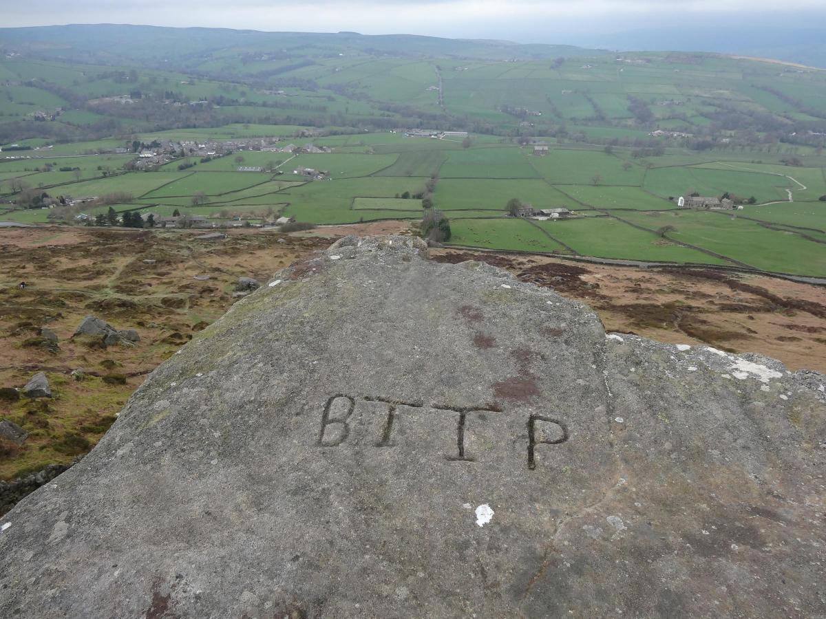
The small manor of Stott Hill was one of three manors in the township of Cowling, the other two being Ickornshaw and Cowling Hill. Since the 17th century it had been under the lordship of the Parker family, who were originally from Extwistle Hall, near Burnley, but later of Cuerden Hall, a large estate outside Preston. During the 18th century as the lords of Stott Hill they had marked the boundary stones of the manor with their initials, BP for Banastre Parker, TTP for Thomas Townley Parker and RTP for Robert Townley Parker.
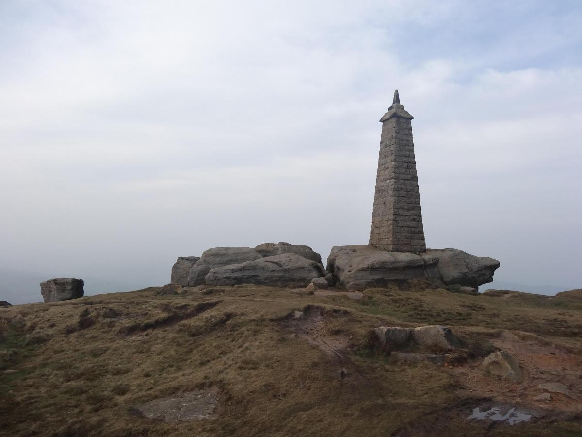
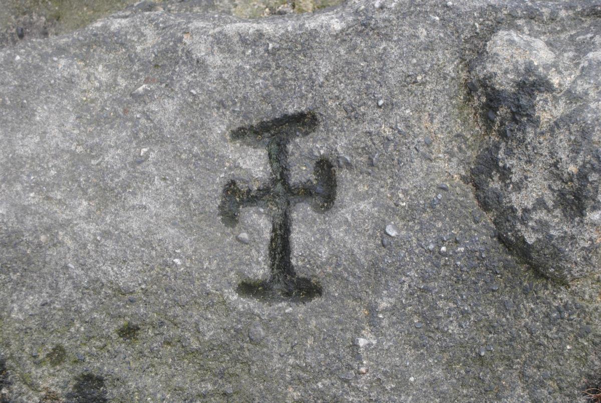
The freeholders of Sutton had marked their boundary stones with a cross, more specifically a cross moline. The cross moline, or millers cross, was not dissimilar to a Maltese cross and was the heraldic device of the Copley family who had been lords of the manor. The last lord, Alvery Copley, had sold his lands to freeholders in the village during the early 17th century. Ancient crosses had been cut into the Hitching Stone, on the moor above the village, and on the Cempfoot Stone, the highest of several rocks at Cowling Pinnacle. These two boundary stones, together with Lane Ends Sike (which ran into Holme Beck, or Glusburn Beck, depending on which village you lived in), marked the western boundary of Sutton with Stott Hill.
The Parkers owned all of Stott Hill Moor and most of the farms in the manor. However, they also owned a farm called Smithy Croft, that stood just inside the Sutton boundary, and this appears to have been the cause of the dispute. The Parkers were apparently unhappy that their tenants had to pay local tax to the Sutton town purse rather than that of Stott Hill in Cowling.
Therefore, during the last quarter of the 18th century, Thomas Townley Parker redrew the Stott Hill boundary to include Smithy Croft and stones were marked with his initials to indicate the new line. This resulted in the long and contentious dispute with their neighbours. The freeholders of Sutton attempted to resolve the issue in 1797 by “making additional mears or marks in the Line you & the Inhabitants of Stotthill saw us Walk on the 14th Aug last putting the cross at different distances between the ancient Boundary Stones".
The matter dragged on unresolved until 1815 when an Act of Parliament was passed to enclose the moors and wastes in Sutton. William Burton, of Carla Beck in Carleton, near Skipton, was appointed the Government commissioner to oversee the process. Aware of the dispute, he made it clear that he alone would determine the line of the boundary "by the Examination of Witnesses upon Oath, or Affirmation, and such other Ways and Means, as to me seem proper". He also added that "if the Boundaries are not then sufficiently ascertained and distinguished, I shall proceed to ascertain, set out, determine and fix the same under and by Virtue of the Powers and Authorities given to me in and by the above mentioned Act".
He appears to have been unimpressed with Parker’s attempt to redraw the boundary and he found in favour of the freeholders of Sutton. Thomas Townley Parker’s son, Robert Townley Parker, seems to have been so vexed by the decision that he eventually demolished Smithy Croft and rebuilt it within the boundary of Stott Hill. Ironically the locally prominent landmark, Cowling Pinnacle, stands a few yards within the Sutton boundary.


Comments: Our rules
We want our comments to be a lively and valuable part of our community - a place where readers can debate and engage with the most important local issues. The ability to comment on our stories is a privilege, not a right, however, and that privilege may be withdrawn if it is abused or misused.
Please report any comments that break our rules.
Read the rules here